
News Summary
Central Florida is bracing for an unsettled weather pattern over the weekend, with heavy rain and storms expected to disrupt the last days of summer vacation. The National Weather Service warns of potential flash flooding and severe thunderstorms, with rainfall projections of 1-3 inches and gusts reaching up to 55 mph. Residents should stay alert as storm activity peaks in the afternoons and evenings, and a weak tornado has been reported in the region, illustrating the heightened weather concerns faced by the community.
Orlando
An unsettled weather pattern in Central Florida is expected to continue throughout the weekend, bringing numerous showers and storms that may disrupt the final days of summer vacation for students and teachers. The National Weather Service has reported that storm activity will likely peak during the afternoon and evening hours, primarily between 5 p.m. and 10 p.m., making it crucial for residents to stay informed about changing weather conditions.
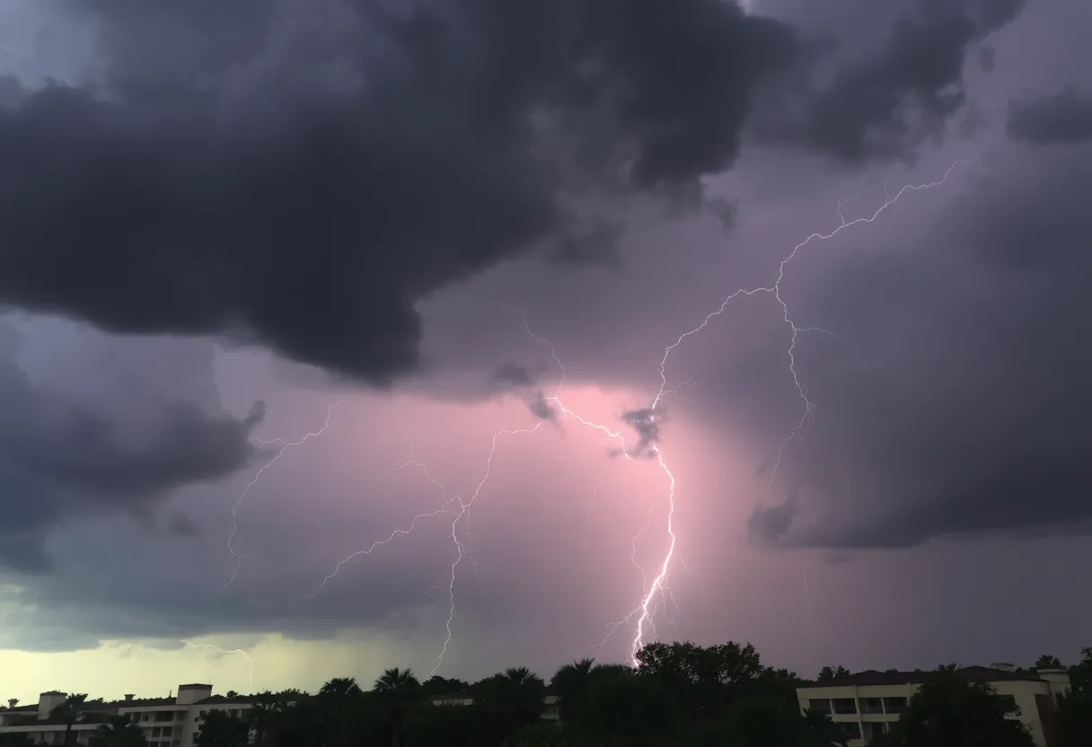
Elevated moisture levels in the atmosphere could lead to torrential rain and flash flooding, particularly as some storms become intense, potentially producing gusty winds and vivid lightning. Gusts from these thunderstorms could reach up to 55 mph, further adding to concerns of severe weather. Morning temperatures this weekend will start pleasantly but are expected to heat up to around 90 degrees before storms commence.
Weekend Rainfall Expectations
Rainfall amounts during the storms can be substantial, with predictions of 1-3 inches, increasing the chance of localized flooding across the region. Last week alone, over 13,000 lightning strikes were recorded in Central Florida, signaling an uptick in storm activity and further days of unsettled weather. Additionally, a weak tornado was reported to have touched down in Osceola County recently, illustrating the intensity of recent weather events.
As this stormy weekend unfolds, residents should remain alert to possible changes in weather patterns. A low-pressure system near the southeast U.S. coast is being monitored for its potential development into a tropical system, which could increase rain coverage starting Thursday. Currently, a broad area of disorganized thunderstorms has been noted with a low chance (20%) of development, alongside a tropical wave marked as Invest 96L, which has a 60% chance of developing over the coming week.
Looking Ahead to Early Next Week
Monday morning is projected to start dry with muggy conditions as students wait at bus stops, with temperatures in the upper 70s and partly cloudy skies. Highs for Monday are expected to rise into the lower 90s, coinciding with an area of high pressure that is predicted to limit widespread storms and boost sunshine. As the work and school week progresses, temperatures may elevate further into the mid and upper 90s, with a likely decrease in rain chances.
Persistent Weather Concerns
The National Weather Service continues to warn of potential flash flooding and severe thunderstorms due to the active weather pattern that is expected to maintain scattered storm events into the coming week. With already saturated ground from previous weeks, the risk for flooding remains heightened. The storms are potentially driven by a combination of tropical influences and a weak atmospheric boundary in the area.
Even as Post-Tropical Dexter has moved away from the mainland and is no longer a threat, it may still cause larger ocean swells affecting the Atlantic coastline. Therefore, everyone in Central Florida, especially those in flood-prone areas, should remain vigilant as weather conditions remain unpredictable and continue to evolve.
In conclusion, as summer vacation concludes and the school year approaches, both students and teachers should prepare for a weekend of unsettled weather characterized by numerous storms and potential flooding, marking a challenging end to their summer break.
Deeper Dive: News & Info About This Topic
HERE Resources
Winter Weather Forecast Predicts Colder, Snowier Season Ahead
Mortgage Rates Drop to 10-Month Low, Sparking Buyer Opportunities
Orlando Homebuyers Benefit from Drop in Mortgage Rates
Orlando Secures Victory at the Arnold Palmer Invitational
Orlando Man Charged with Vehicular Homicide After Police Pursuit
Orange County Mayor Signs Agreement with ICE Under Duress
Altamonte Springs Home Catches Fire, Residents Safe
Franky’s Deli Warehouse Named Top Sandwich Shop in the US
Orlando Faces Record Electricity Demand Amid Heatwave
Orlando Science Center: A Family-Friendly Destination
Additional Resources
- Fox 35 Orlando: Numerous Showers & Storms
- Google Search: Central Florida weather forecast
- WESH: More Storms & Lightning Strikes
- Wikipedia: Weather in Florida
- Click Orlando: Active Weather Pattern
- Encyclopedia Britannica: Weather
- MSN: Strong Storms Bring Heavy Rain
- Google News: Orlando weather news
- Fox 35 Orlando: Weather Forecast August 7
- Google Scholar: Severe Weather in Florida

Author: STAFF HERE ORLANDO WRITER
ORLANDO STAFF WRITER The ORLANDO STAFF WRITER represents the experienced team at HEREOrlando.com, your go-to source for actionable local news and information in Orlando, Orange County, and beyond. Specializing in "news you can use," we cover essential topics like product reviews for personal and business needs, local business directories, politics, real estate trends, neighborhood insights, and state news affecting the area—with deep expertise drawn from years of dedicated reporting and strong community input, including local press releases and business updates. We deliver top reporting on high-value events such as Orlando International Fringe Theatre Festival, Megacon Orlando, and Central Florida Fair. Our coverage extends to key organizations like the Orlando Economic Partnership and Hispanic Chamber of Commerce Metro Orlando, plus leading businesses in leisure and hospitality that power the local economy such as Walt Disney World Resort, AdventHealth, and Universal Orlando. As part of the broader HERE network, including HEREJacksonville.com, HEREPetersburg.com, HERETallahassee.com, and HERETampa.com, we provide comprehensive, credible insights into Florida's dynamic landscape.