
News Summary
Hurricane Erin, having rapidly strengthened in the Caribbean, is expected to remain offshore but will create strong winds and hazardous sea conditions along the East Coast. Virginia, Maryland, and Delaware beaches are under tropical storm watches as wave heights are forecasted to exceed nine feet. Beachgoers are warned about potential rip currents and unsafe swimming conditions. Meanwhile, Tropical Storm Chantal has also formed, leading to heavy rainfall and flash flooding concerns in the Carolinas. Residents are urged to stay alert and follow safety advisories.
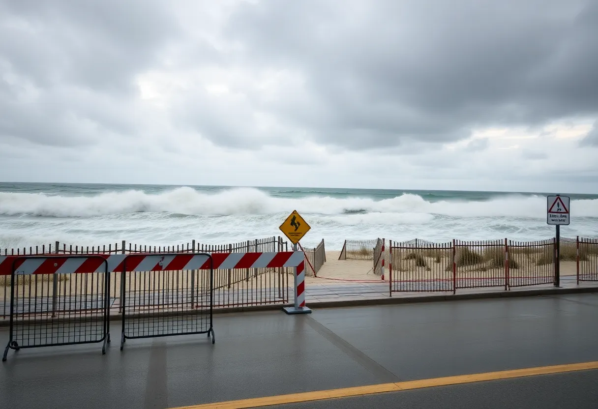
Hurricane Erin Misses East Coast but Delivers Dangerous Waves and Rip Currents
Over the weekend, **Hurricane Erin** underwent **explosive strengthening** as it made its way through the **Caribbean**. Despite its impressive growth, Erin is expected to stay offshore, which is good news for residents along the coast, but it isn’t all sunshine because this storm is bringing along **strong winds** and **risky sea conditions** that could really affect the picturesque beaches of **Virginia, Maryland, and Delaware**.
Tropical Storm Watch Expands
Tropical storm watches have **expanded** from **Virginia beaches** down to **Fenwick Island, Delaware**, and this includes popular spots like **Ocean City, Maryland**. Beachgoers hoping to soak up some sun should keep a close eye on weather updates, as the ongoing unpredictable conditions could disrupt vacation and beach plans going into the weekend.
Waves and Wind Predictions
As Erin progresses into mid-week, **Ocean City, Maryland**, is bracing for a significant **increase in wave heights**. The peak is expected to hit **Wednesday night** into **Thursday**, and residents should be prepared for wave heights potentially surpassing **nine feet**. Areas like **Rehoboth, Dewey, and Bethany** in Delaware could also see similar conditions, particularly on Thursday afternoon. After Thursday, wave heights are predicted to gradually decrease as Erin continues on its eastward path.
Rip Currents and Hazards
One of the major concerns this week will be the **rip currents** that arise as Erin passes by. These currents pose a **significant danger** to swimmers and beachgoers, making conditions quite treacherous. Locals and visitors alike are strongly advised to heed safety warnings and remain vigilant while enjoying the coast.
Wind Gusts Impacting Weather
Winds are set to pick up as well, with gusts likely reaching between **35 and 45 mph** across the **Delmarva Peninsula** on Thursday. In **Washington, D.C.**, wind gusts could moderate at around **20 to 25 mph**, all thanks to Erin’s robust wind field. This burst of wind can significantly impact local weather and should not be taken lightly.
Updates on Tropical Storm Chantal
At the same time, another storm named **Tropical Storm Chantal** formed off the coast of **South Carolina** and made landfall early Sunday, quickly weakening to a **tropical depression**. Chantal is taking its toll in the form of **flash flooding warnings** across the Carolinas and coastal regions all the way up to Delaware. Rainfall rates have been reported to reach between **1-2 inches per hour** in some areas, leading to potential for **flash floods**.
Heavy Rainfall Expected
The heaviest rainfall from Chantal is anticipated near **Wilmington, North Carolina**, and **Myrtle Beach, South Carolina**, where totals could hit between **4 and 8 inches**. The **National Hurricane Center** has cautioned that Chantal’s rainbands could lead to isolated flash flooding, particularly in areas that are low-lying or poorly drained.
Final Thoughts
For residents and visitors in coastal areas, staying up to date on the storm developments is crucial. Local emergency management officials are encouraging everyone to follow **advisories and warnings** related to both Hurricane Erin and Tropical Storm Chantal as safety should always come first. So perhaps it’s best to grab those beach towels and keep an eye on the sky because weather can change in a heartbeat! Stay safe and enjoy your week, beach lovers!
Deeper Dive: News & Info About This Topic
- Washington Post: Hurricane Erin Misses East Coast but Delivers Dangerous Waves
- Fox 5 DC: Hurricane Erin Misses East Coast
- News Leader: Tropical Depression Chantal Update
- USA Today: Tropical Depression Chantal Path Tracker
- Wikipedia: Hurricane

Author: STAFF HERE ORLANDO WRITER
ORLANDO STAFF WRITER The ORLANDO STAFF WRITER represents the experienced team at HEREOrlando.com, your go-to source for actionable local news and information in Orlando, Orange County, and beyond. Specializing in "news you can use," we cover essential topics like product reviews for personal and business needs, local business directories, politics, real estate trends, neighborhood insights, and state news affecting the area—with deep expertise drawn from years of dedicated reporting and strong community input, including local press releases and business updates. We deliver top reporting on high-value events such as Orlando International Fringe Theatre Festival, Megacon Orlando, and Central Florida Fair. Our coverage extends to key organizations like the Orlando Economic Partnership and Hispanic Chamber of Commerce Metro Orlando, plus leading businesses in leisure and hospitality that power the local economy such as Walt Disney World Resort, AdventHealth, and Universal Orlando. As part of the broader HERE network, including HEREJacksonville.com, HEREPetersburg.com, HERETallahassee.com, and HERETampa.com, we provide comprehensive, credible insights into Florida's dynamic landscape.