
News Summary
Central Florida is bracing for an increase in rain and thunderstorms as meteorologist Noah Bergren predicts a shift in weather patterns starting Thursday. While the early part of the week remains mostly dry, humidity is set to rise, boosting storm chances to 40-60% by the weekend. Residents can expect warm temperatures in the low to mid-90s, with possible heat indices reaching 100 degrees. Additionally, an area of low pressure near Bermuda is being monitored for potential development into a tropical depression or storm.
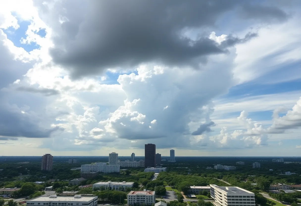
Orlando, Florida – Late this week, Central Florida is expecting an increase in chances of rain and thunderstorms, as forecasted by meteorologist Noah Bergren. While the early part of the week will remain mostly dry, with limited rain activity, conditions are set to shift, bringing scattered storm chances by the weekend.
Currently, only a few thundershowers are anticipated along the Interstate 75 corridor, but overall precipitation levels are expected to be minimal through early evening. As the temperatures drop into the mid-70s, typical for this time of year, residents can expect a mix of cloud cover and sunshine. Inland areas will see daytime highs reaching into the low to mid-90s, slightly above seasonal averages.
From Monday to Wednesday, onshore winds will be noticeable, blowing at speeds of 10 to 15 mph, with coastal areas experiencing stronger gusts due to the sea breeze. Although these windy conditions may bring about some relief from the heat, the overall rain chances remain low, ranging from 20% to 30%. The atmosphere is currently laden with dry air, which suppresses the development of widespread thunderstorms and showers.
However, starting Thursday, the weather pattern over Florida is projected to become more conducive to rain and storms. The humidity and moisture levels in the atmosphere are expected to rise significantly by week’s end, creating a favorable environment for afternoon and evening thunderstorms. Rain chances are predicted to escalate to between 40% to 60% as scattered storms become more likely.
The National Hurricane Center is also monitoring an area of low pressure approximately 500 miles east of Bermuda, which has a 70% possibility of development over the next 48 hours. Should this system develop, it may become a short-lived tropical depression or named storm. Nevertheless, conditions are anticipated to become less favorable for further development by Tuesday, as the system continues moving toward the northern Atlantic.
This weekend, Central Florida residents can expect the best chance of rain on Saturday, particularly around the mid-afternoon hours. Areas west of Orlando will likely be the most affected. Although severe weather is not anticipated over the weekend, forecasters caution that stronger storms could produce wind gusts of 40 mph, along with potential lightning and heavy rainfall. With the forecasted high temperatures still hovering in the low to mid-90s, the heat index values may feel as high as 100 degrees.
As Father’s Day approaches, hot temperatures are expected to continue. Daytime highs are projected to reach the low to mid-90s, and there may be increased rain chances, particularly near coastal areas. For many, the weather changes over the upcoming week will revolve primarily around afternoon temperatures, as sustained dry conditions currently contribute to persistent heat.
Looking ahead, if the current forecast proves accurate, 2025 would mark the first June since 2019 to pass without a named tropical system emerging in the Atlantic basin. Meteorological trends in the coming days will indicate how this month progresses regarding both temperature and rain activity, providing critical insights as summer officially begins in Central Florida.
Deeper Dive: News & Info About This Topic
HERE Resources
Luxury Home Sells for $1.8 Million in Dr. Phillips
Central Florida’s Transition to Hot and Mostly Dry Weather
Apopka City Council Approves Mobile Shelter Bus Initiative
Central Florida Set for Hot and Dry Week Ahead
Severe Tornado Strikes Longwood, Florida Community
Casting Calls Abound for Actors in Orlando
Orlando to Host 2025 Hurricane Expo Focusing on Preparedness
Apopka City Moves Forward with Mobile Shelter Bus Initiative
Florida’s Gulf Coast Recovery Efforts Amid Hurricane Challenges
Man Arrested for Threat Against Orlando Pride Event
Additional Resources
- Fox 35 Orlando
- NBC Miami
- Click Orlando
- Orlando Sentinel
- WFTV
- Wikipedia: Weather
- Google Search: Orlando Weather Forecast
- Google Scholar: Central Florida Weather
- Encyclopedia Britannica: Climate
- Google News: Florida Weather News

Author: STAFF HERE ORLANDO WRITER
ORLANDO STAFF WRITER The ORLANDO STAFF WRITER represents the experienced team at HEREOrlando.com, your go-to source for actionable local news and information in Orlando, Orange County, and beyond. Specializing in "news you can use," we cover essential topics like product reviews for personal and business needs, local business directories, politics, real estate trends, neighborhood insights, and state news affecting the area—with deep expertise drawn from years of dedicated reporting and strong community input, including local press releases and business updates. We deliver top reporting on high-value events such as Orlando International Fringe Theatre Festival, Megacon Orlando, and Central Florida Fair. Our coverage extends to key organizations like the Orlando Economic Partnership and Hispanic Chamber of Commerce Metro Orlando, plus leading businesses in leisure and hospitality that power the local economy such as Walt Disney World Resort, AdventHealth, and Universal Orlando. As part of the broader HERE network, including HEREJacksonville.com, HEREPetersburg.com, HERETallahassee.com, and HERETampa.com, we provide comprehensive, credible insights into Florida's dynamic landscape.